Plant Spatial Points Tool
![]()
- This is a software about annotation for plant spatial points, need PostgreSQL, build application in Python 3.7
- It can help build data for analysis about relationships in plant ecology
- Windows Releases
PostgreSQL setting(with pgAdmin)
- set server default
- set password -> 2717484
- create a database {your database name}
- set a relation {your relation name}(e.g., plotdata)
- set column, including x1,y1,x2,y2,tag,sp,dbh,x3,y3, set dbh as numeric. Otherwise, text
- set tag as primary key(in Constraints setting)
- import data(csv format, and UTF-8 is encoding)
About relation column names
- x1,y1,x2,y2 -> plot position
- tag -> plant ID
- sp -> species name
- dbh -> diameter breast height
- x3,y3 -> plants points position, record by this program
Commonly used sql commands
in SQL Eidtor
select * from plotdata-> select all data from plotdataselect * from plotdata where x3 is null-> select x3 data is null from plotdata
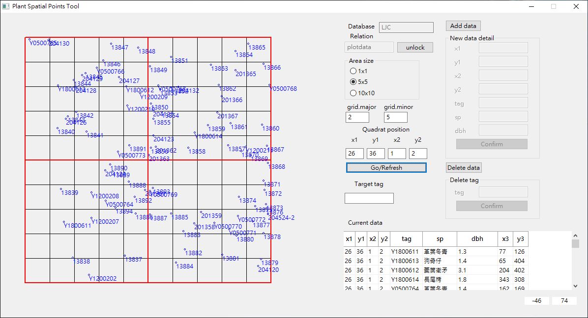
User guide
- enter the database and relation name, and lock
- choose area(meter)
- set main/sub grids, e.g., (1,5)/(2,5)/(3,3)
- set quadrat
- click ‘Go/Refresh’ button
- enter target tag
- click on the map
Screenshot
Citation
Yao-Wen Lee (2022) Plant Spatial Points Tool. URL: https://github.com/leeyaowen/Plant-Spatial-Points-Tool DOI: 10.5281/zenodo.6931327